Geographic Information Systems (GIS)
Geographic Information Systems (GIS) is a systems for capturing, analyzing, and visualizing spatial and geographic data.
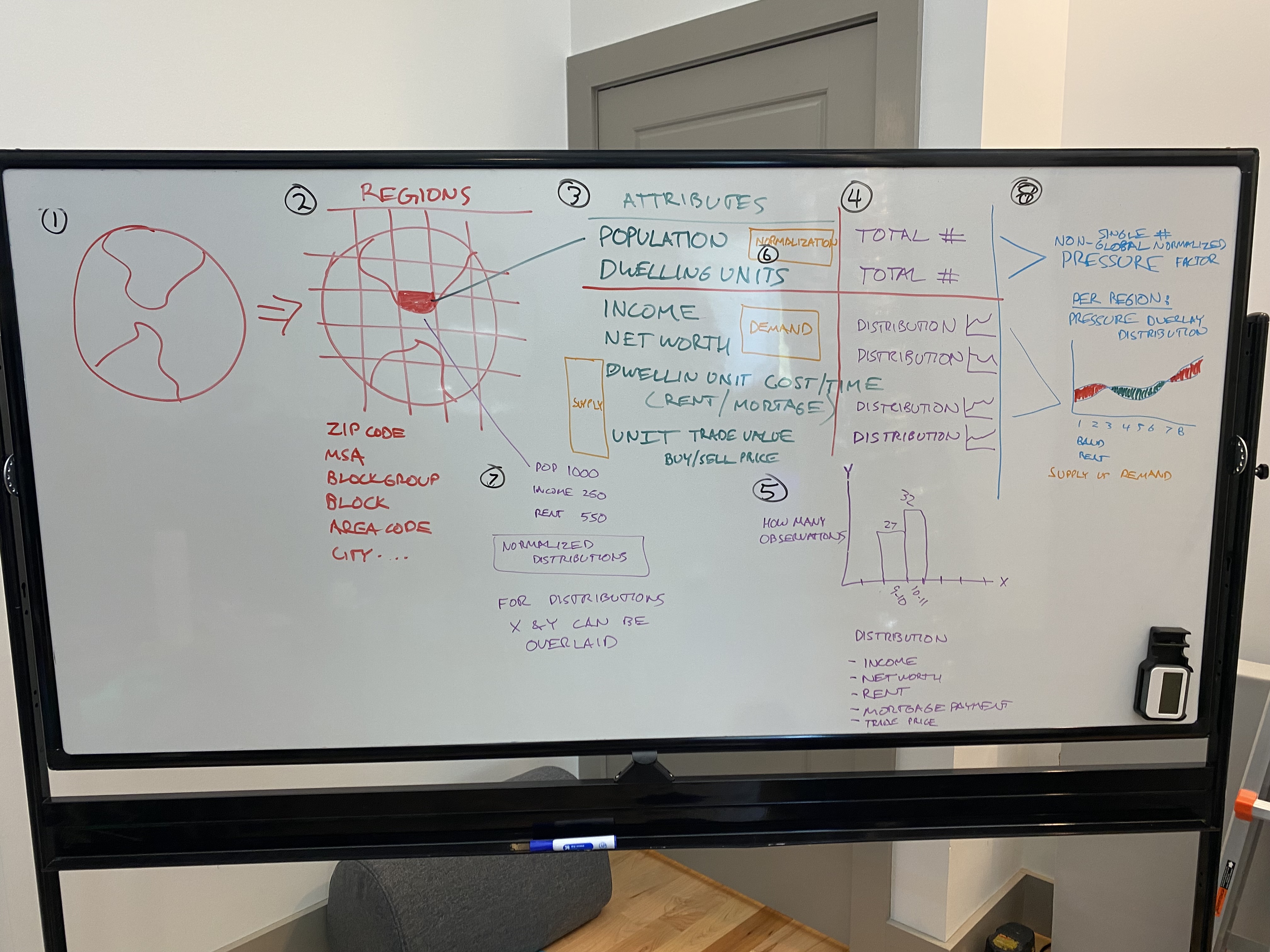
Geospatial Systems
Systems model physical space using coordinates, polygons, and clustering to derive insights and build products from location data.
Systems model physical space using coordinates, polygons, and clustering to derive insights and build products from location data.
This domain is valuable because data and AI systems expose the full path from collection to action. They make it obvious that storage, transformation, meaning, trust, and incentives all shape the value of the output.
The transfer advantage is strong here. Learning to ask where data came from, how it changed, and who is rewarded by its use builds a habit that improves product, operational, and strategic thinking in other domains. This domain gets more useful when it is compared with adjacent systems instead of being treated as a silo. That is where reusable judgment starts to form.
Geographic Information Systems (GIS) is a systems for capturing, analyzing, and visualizing spatial and geographic data.
Spatial systems represent and analyze location-aware data so geographic relationships can be integrated into products and decisions.