Data Brokering
Data Brokering is the collection, aggregation, and sale of data from multiple sources.
Data Engineering and Big Data
Projects building data pipelines, warehouses, lakes, and large-scale analytics infrastructure.
Data Brokering is the collection, aggregation, and sale of data from multiple sources.
Tracking systems record the origin, transformations, and dependencies of data across pipelines and reports.
Market structures exchange data as a product by aligning suppliers and consumers through pricing, packaging, and access controls.
Frameworks govern how data is stored, shared, and used to meet legal, contractual, and ethical expectations.
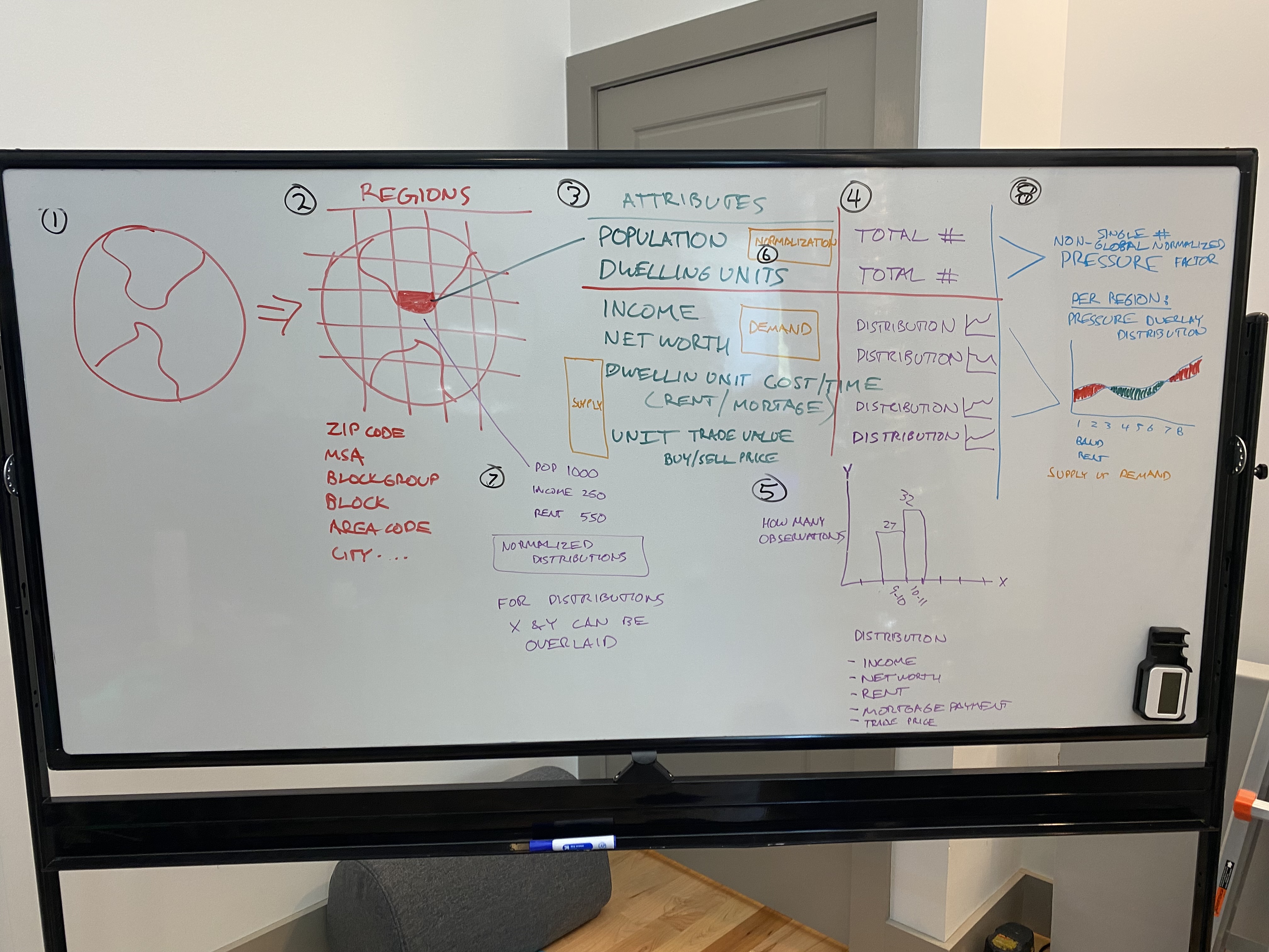
Data Product Development is the process of building products that leverage data to deliver value to users.

Processes and tools ensure data accuracy, completeness, and consistency through validation, monitoring, and correction.
Solutions architect role redesigning a fundamentally flawed Pentaho ETL into a scalable AWS Redshift data warehouse for a hospitality leader. Identified root...
Dataset Development is the creation, curation, and refinement of datasets for analysis or product use.
Raw data is turned into standardized, consumable products with defined schemas, documentation, and delivery mechanisms.
Demand-Side Platform (DSP) Concepts is a frameworks for automated purchasing of digital advertising inventory.